What Happened?
The floods that occurred in Saguenay on July 19, 20, and 21, 1996, are the result of natural factors such as weather conditions, soil type, topography, hydrography, as well as human occupation of the territory.
Here’s what happened and why.
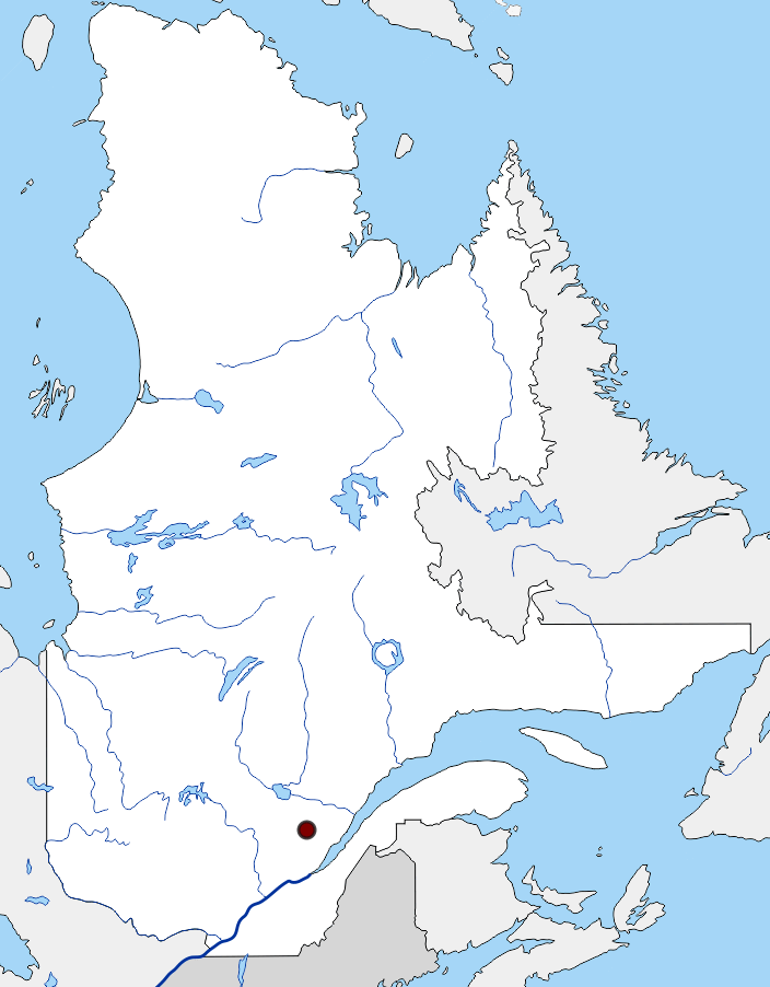
As a result of favourable weather conditions, a thick spiral of clouds hovered over the Laurentides Wildlife Reserve, causing between 170 and 200 millimetres of rain to fall in 36 hours and 250 millimetres in 48 hours, which is the amount of rain that typically falls in a month in this area. If this rainfall had fallen during the winter, Saguenay–Lac-Saint-Jean would have received three metres of snow!
A Stationary Weather System

The cloud band of the tropical storm is recognizable by its comma-shaped form.
© Applied Geography Expertise and Research Laboratory (UQAC)
Mountains that Bring Rain
The
highly mountainous terrain of the Laurentian Wildlife Reserve amplified the
formation of rains. When
clouds reach this region, the mountains force them to rise. As the air rises,
it cools, and the water in the clouds condenses, making it easier to turn into
rain. All this water flowed north into the valleys and rivers below.
It’s as if the mountains had “squeezed” the
clouds … and they had emptied their buckets all at once!
Due
to its rugged topography, the Laurentian massif is one of the places where it
rains the most in Quebec. Heavy precipitation often occurs in a short period
of time.
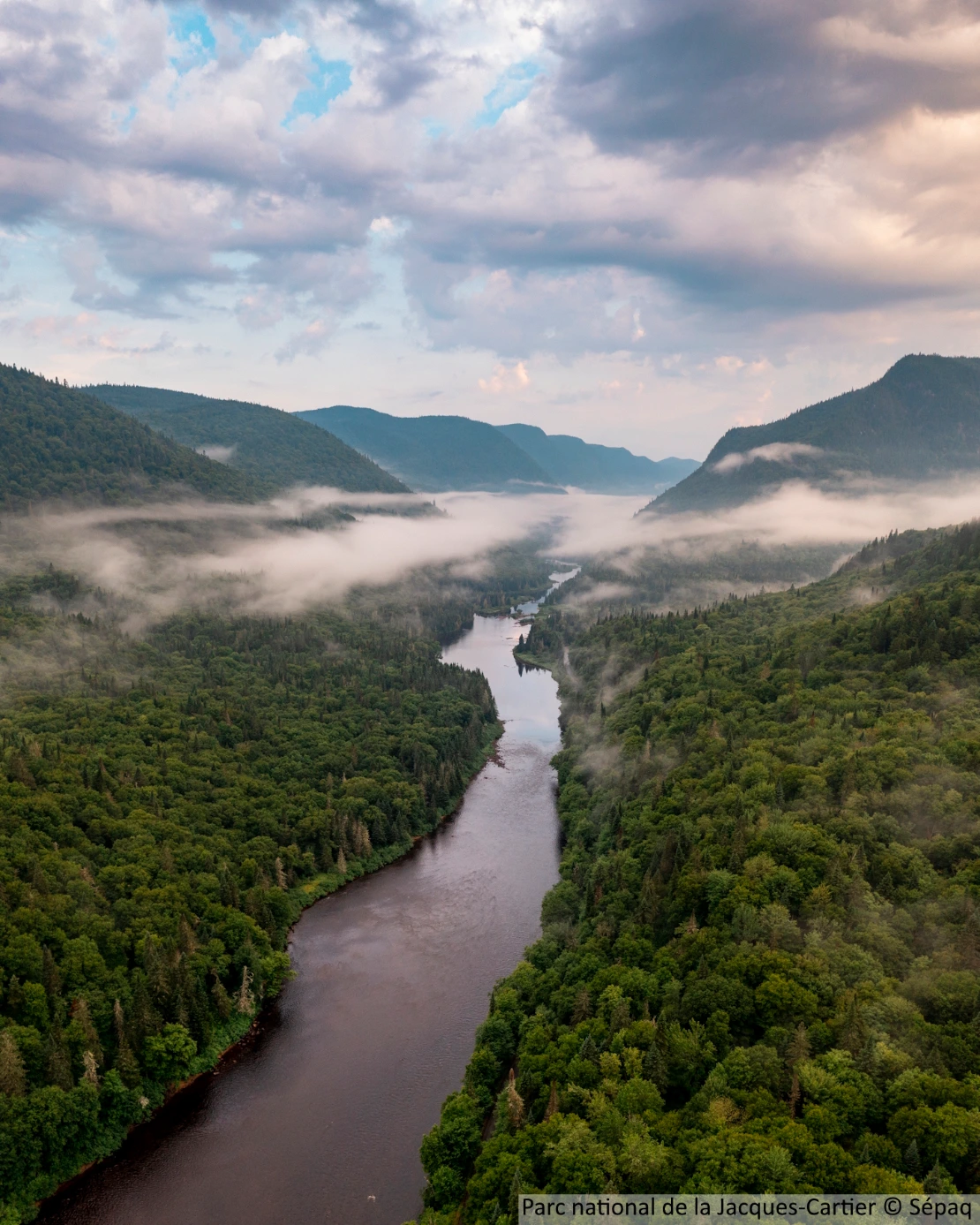
Jacques-Cartier National Park, Sépaq.
Soils Already Saturated with Water
By the time torrential rains hit the Saguenay region, the ground was already saturated with water. Indeed, between July 1 and 17, 1996, this territory received 120.5 millimetres of water, which is equivalent to the amount of rain that generally falls throughout the month of July.
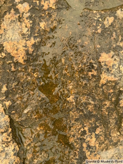
The Saguenay-Lac-Saint-Jean region is based on the Canadian Shield, a landmass mainly composed of granite. Because this igneous rock is very low in porosity, rainwater can hardly seep into it, except through cracks.
Far Too Much Water in One Place
The rains on July 19 and 20, 1996, fell in the wrong place.
Instead of spreading over a large area, all this water fell into a kind of long corridor or
elongated ditch, which corresponds to the Kénogami
Reservoir and its watershed. As this area is narrow, a huge amount of water was concentrated in it all at once.
The Kénogami Reservoir, already full to
the brim before the storm, was unable to absorb all this extra water. As a
result, it has overflowed, much like an overflowing glass that continues to be
filled
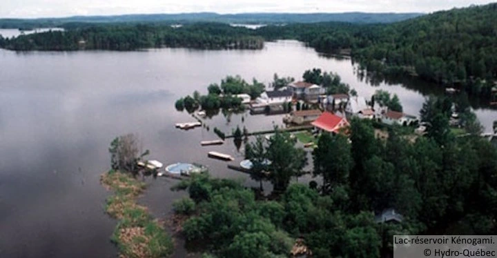
The amount of rainfall in the Kénogami Reservoir Lake watershed corresponds to the volume of liquid contained in 11,600,000 50 cubic metre tank trucks. The lake therefore received ten metres of water, which it then had to evacuate. In total, six rivers that flow into the Saguenay River have left their beds.
Consequently…
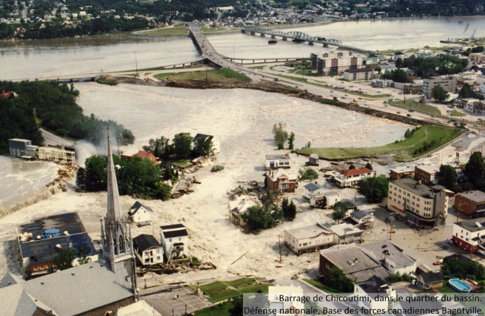
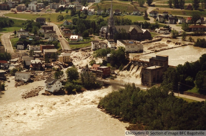
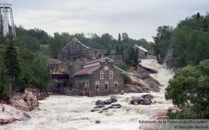
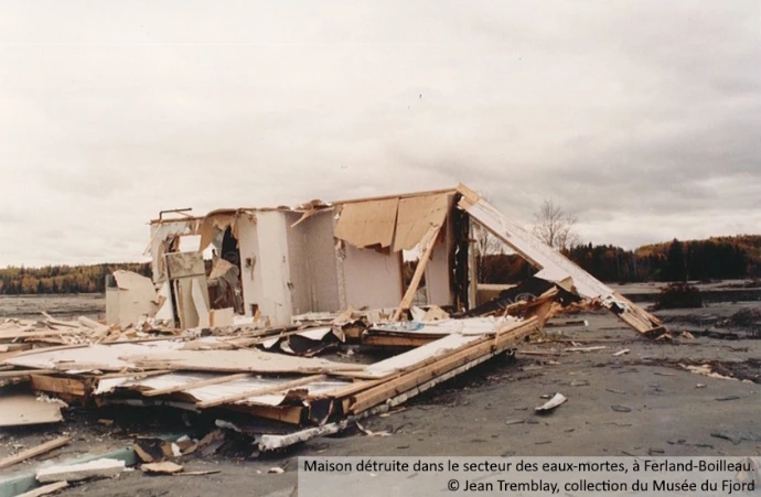
As a precautionary measure and out of concern that the Kénogami Lake dam might crack or fail, Hydro-Québec fully opened the gates. The sudden increase in flow profoundly transformed the course of the Chicoutimi River, whose modified bed led to the flooding of neighbouring lands. Many farms, homes, and cottages were then submerged or literally washed away by the waters. The river also overflowed by bypassing the Chute-Garneau dam, which caused the flooding of the Bassin area, where several residences and businesses were destroyed.
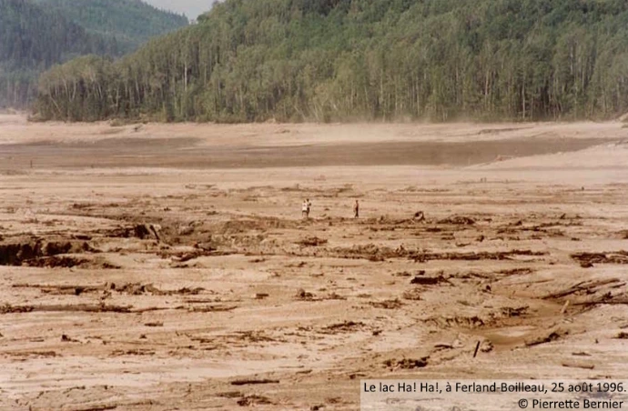
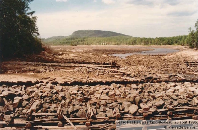
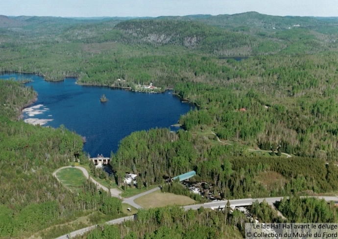
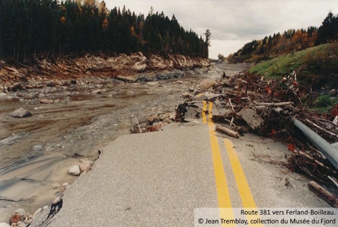
At the same time, the earthen dike of Ha! Ha! River broke, which drained the lake almost completely in less than 18 hours. In turn, the flow of the Ha! Ha! River increased dramatically, causing it to burst its banks and, in the process ravaging several roads. The municipalities of Bas-Saguenay, as well as that of Ferland-et-Boileau, were literally cut off from the rest of the world.
In La Baie, the widening of the À Mars riverbed caused major damage to many houses, road infrastructure and bridges. The Alcan railway system was also affected. In the Grande-Baie sector, the steep sections of the Ha! Ha! River left irreversible traces on the urban and natural landscape.
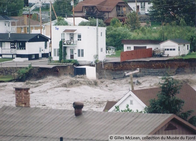
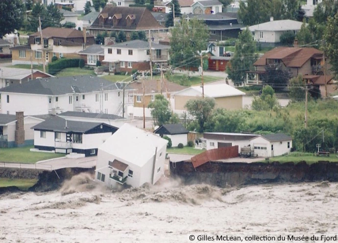
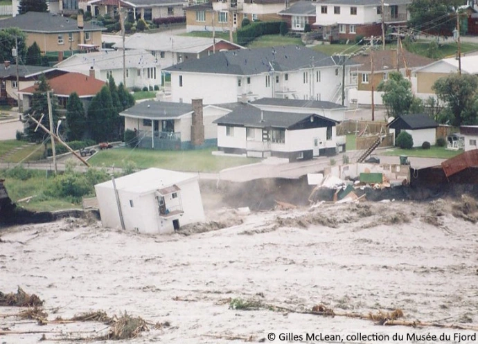
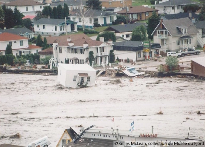
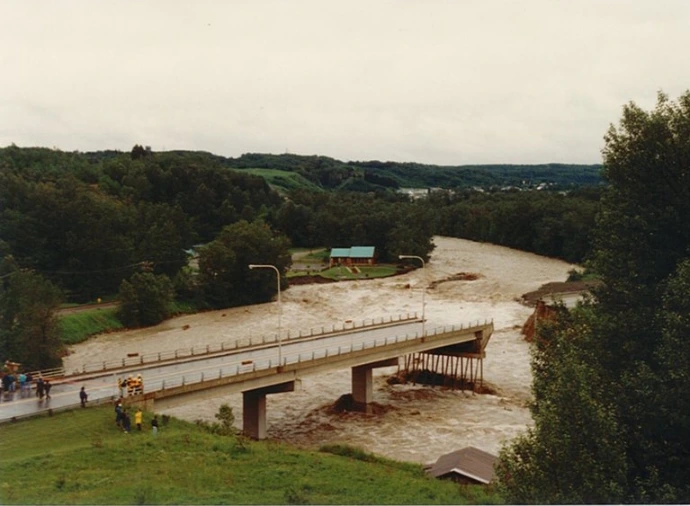
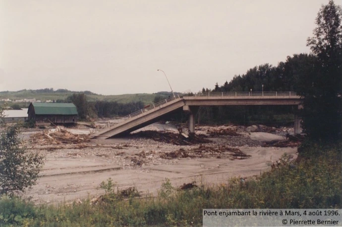
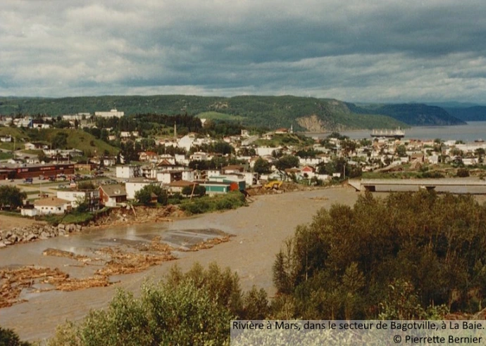
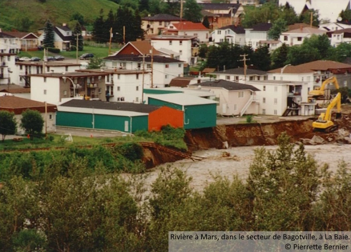
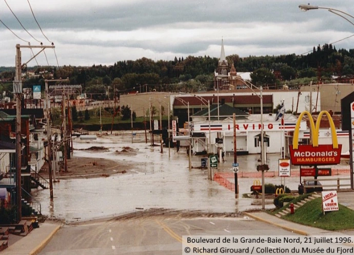
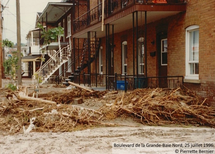
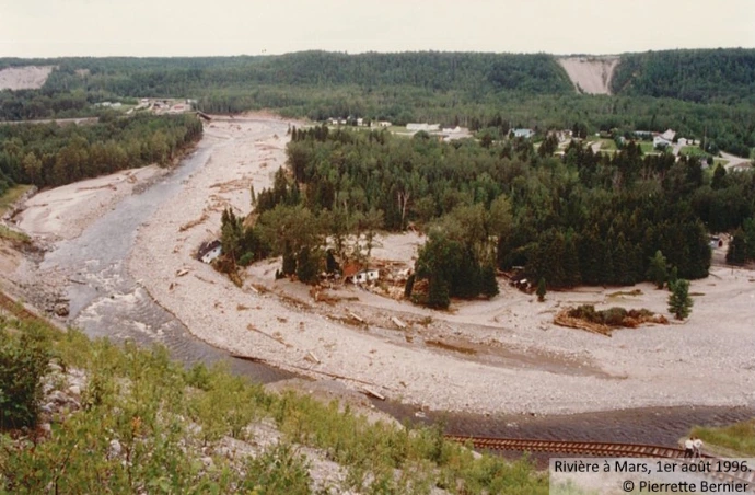
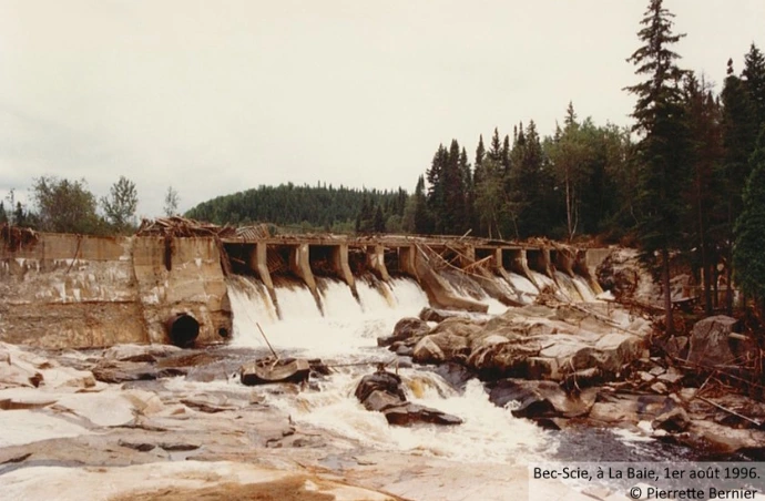
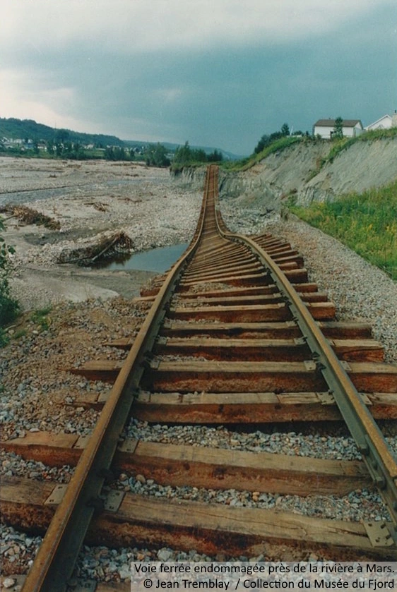
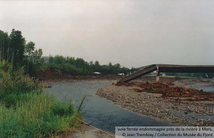
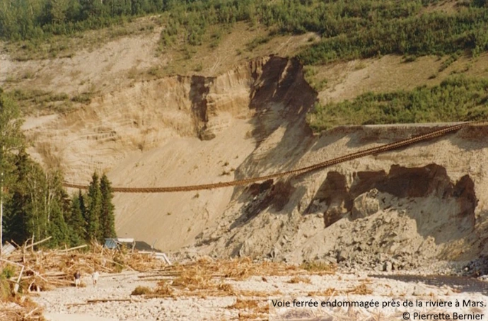
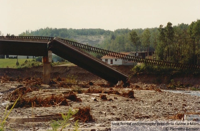
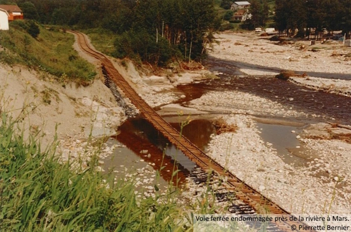
In Jonquière, the Aux Sables River underwent similar transformations. Several buildings in the city centre collapsed, while at least three bridges and two dams were destroyed.
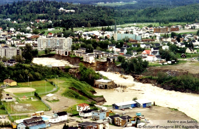
Given the extent of the damage, a state of emergency was quickly declared. Telephone communications were interrupted, access to drinking water became difficult, and numerous power outages were reported. The evacuation operations concern nearly 14,000 people. The tragedy killed two people in the Grande-Baie sector. In summary, approximately 55 farms and commercial establishments endure severe damage, while almost 1,110 homes, businesses, and housing units were destroyed.
Homeau Sapiens
The way human beings occupied the territory had a direct link to the consequences of the floods of July 1996.
Throughout the history of Saguenay–Lac-Saint-Jean, people have settled along waterways, which were the only means of transportation at that time. Later, dikes and dams were built on some lakes and rivers, creating reservoir lakes, such as those of Kénogami and Ha! Ha!. The shorelines have remained populated, and today they are as sought after as ever, even though the risks of flooding are better understood.
In addition to harnessing the main watercourses in the watersheds to exploit water and wood, urbanization has continued its expansion and altered the natural riverbeds. For developmental purposes, certain ones have been filled, redirected, bypassed, diverted, and channelled.
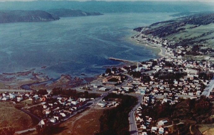
La Baie, secteur de Grande-Baie, avant le déluge.
© Musée du Fjord Collection
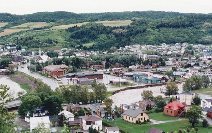
La Baie, secteur de Grande-Baie, pendant le déluge.
© Musée du Fjord Collection
Old and new bed of the Ha! Ha! River in La Baie
In the La Baie sector, the Ha! Ha! River has widened considerably. The riverbed has returned to its natural state.